Mesoscale organization of shallow cumulus convection in present and future climate
Contact: Pier Siebesma (Delft University of Technology), Abraham Torres (ETH)
Shallow Cumulus over the subtropical oceans is the most abundant cloud type in our climate system and its radiative response to global warming is highly uncertain. Previous MIPs on shallow cumulus convection have primarily explored the representation of spatially unorganized shallow cumulus convection and their response to climate warming.
It has become clear however over the last decade that marine shallow cumulus convection has a natural strong tendency to develop into mesoscale organized cloud structures and that unorganized shallow cumulus convection is the exception rather than the rule.
It is particular challenging to realistically simulate these mesoscale cloud patterns. On the one hand, this requires turbulence resolving resolutions to represent the small-scale vertical convective mixing processes while at the same time domains of several hundreds of kilometers are needed to represent the observed mesoscale cloud structures. It is only recently that the computational capability is allowing us to simulate these rich structures.
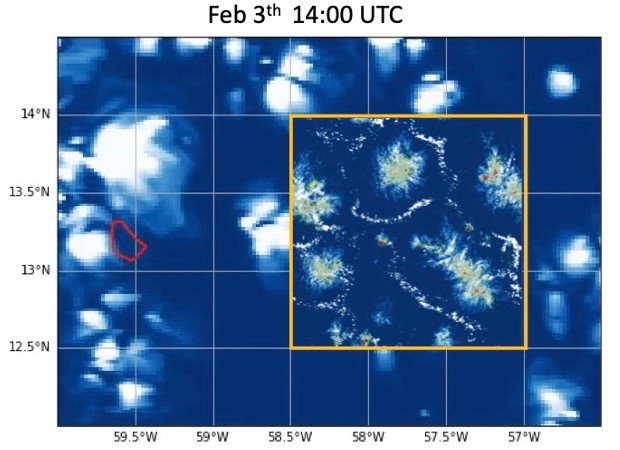
It is for this reason that we propose a MIP on shallow cumulus convection over the Northern Atlantic subtropical ocean such as observed during the EUREC4A field campaign in January-February 2020.
The main objectives of this MIP are:
- assessing the simulation capability of the observed shallow cloud mesoscale organization over the subtropical ocean
- understanding the underlying dynamical processes that lead to these mesoscale cloud patterns
- assessing the radiative response of this abundant cloud regime to climate warming using the Pseudo-Global Warming (PGW) framework.
Ideally this requires models that simulate the atmosphere at turbulent resolving resolutions of 100 meter on domains of several thousands of kilometres. At present this is not yet a numerically feasible option. We therefore propose two different model approaches in this MIP that concentrate on different spatio-temporal domains and resolution:
Storm Resolving Model (SRM) simulations with resolutions in the range of 0.5~2.5 km over a domain of preferably 4000 x 3000 km2 for the whole EUREC4A period of Jan-Feb 2020.
Large Eddy Model (LEM) simulations with resolutions in the range of 50~250 meter over a domain of 500 X 300 km for the period February 1-11 2020.
The simulations will be carried under present day conditions such as observed during the EUREC4A field campaign and additionally for future weather conditions with a +4K SST perturbation and perturbed lateral boundary conditions using a Pseudo Global Warming framework.
For more information on EUREC4A-MIP we refer to the website: https://eurec4a.eu